Improving Weather Forecasts over the West With
Unmanned Sailboats Collecting Weather Observations
Why a Saildrone Experiment Off the West Coast?
The West Coast of North America experiences very
active weather during October through March, with major weather
systems approaching from the west. Such systems
include intense Pacific cyclones that bring strong winds to the
coastal zone as well as atmospheric rivers, plumes of moisture
that can drop large amounts of precipitation as they ascend the
mountainous terrain of the western U.S. NOAA buoys are
sparse over the offshore waters and some are not reporting or have
problematic sensors. Weather satellites are important but
they do not replace measurements in the lower atmosphere and
at the surface. Weather observations from commercial ships
are often of poor quality, with commercial shipping avoiding the
most severe, but important marine weather.
Although weather forecasts have improved greatly, some major
weather systems approaching the West Coast have been poorly
forecast, such as the Ides of October Storm in 2016. Lack of
high-quality weather observations offshore could be part of the
problem.
The Saildrone is a new observational system that offers high
quality atmospheric and oceanographic observations using unmanned
sailboats. Saildrones can remain offshore as long as a year,
are autonomous, robust to high seas and strong winds, and have
continuous satellite communication. More details about the
Saildrone platform is found here.
The essential question to be answered in this experiment is:
can the use of Saildrone observations improve short-term (24-hour
or less) forecasts along the West Coast and for longer projections
to the east?
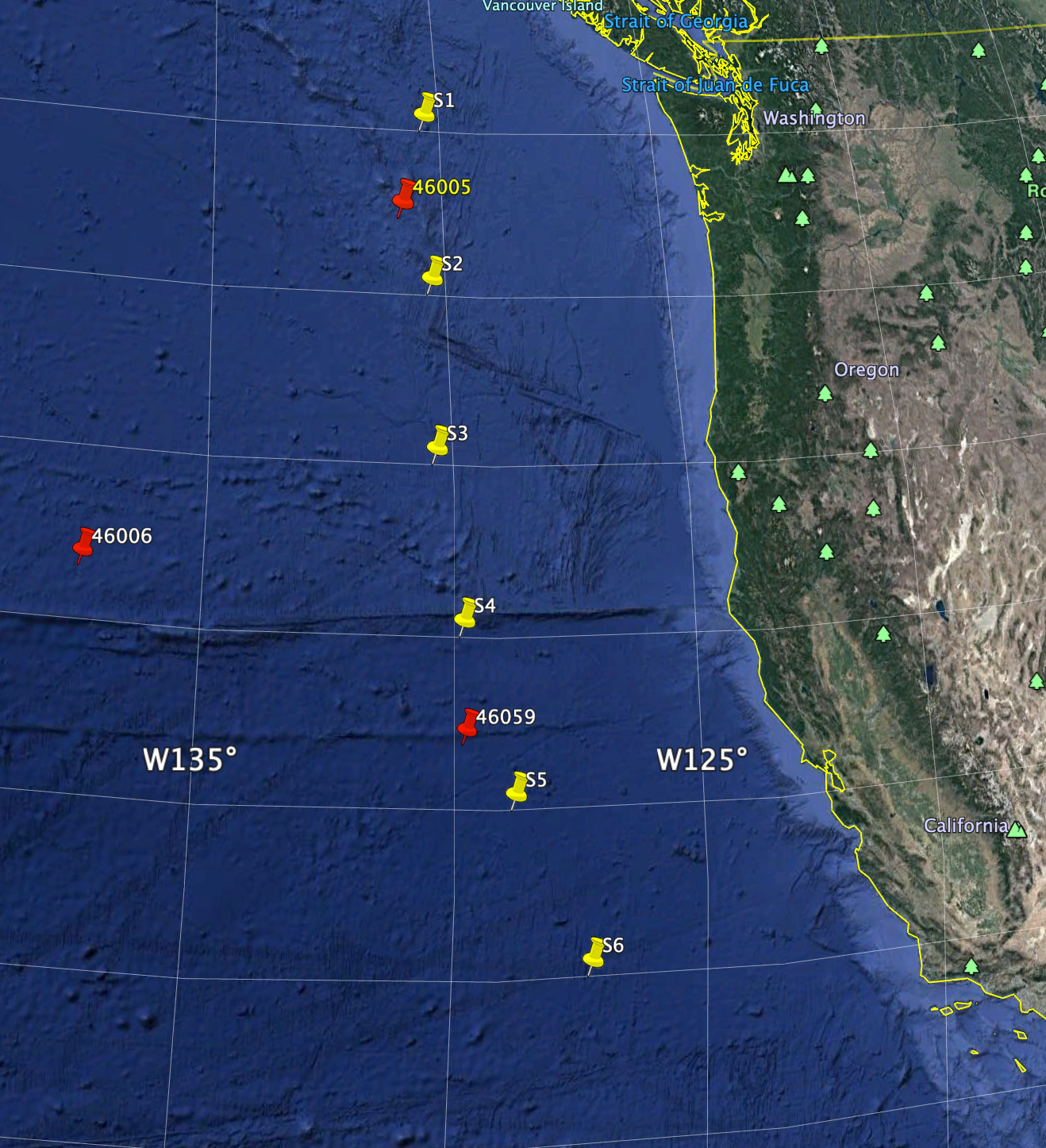
To help answer this question, a fleet of six Saildrones will be
stationed roughly 300 miles offshore in a "picket fence" from due
west of the Olympic Peninsula of Washington State to west of Point
Conception of southern California (see map above) for the
2019-2020 winter. With boats separated by about 170 miles,
this line of Saildrones will provide valuable new information
about approaching weather systems
This project is entirely funded and supported by Saildrone, Inc.
and is a joint project with the University of Washington.
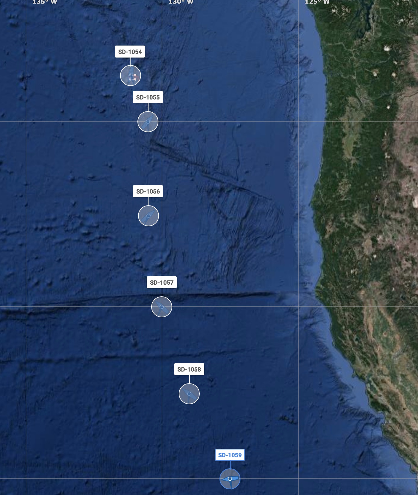
Current Project Status (10/13/2019)
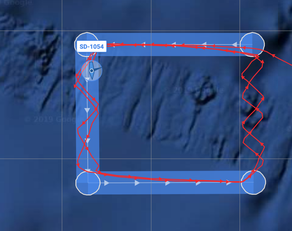
Six Saildrones are now positioned in a line
along the Coast, with the northern-most boat (SD-1054) now
circling NOAA buoy 46005 before moving northward into its final
position. We are now developing the project web pages that
will provide more detailed information and comparison to model
initializations and forecasts.
Projects Operation Page
Provides access to real-time plots of Saildrone
Sentinel observations and comparison of observations with forecast
model observations and forecasts. In the future it will
provide graphics of forecast sensitivity and information on model
simulations initialized using Saildrone observations. Link
is here.
For More Information
Please contact Professors Cliff Mass (cmass@uw.edu) or Greg Hakim
(ghakim@uw.edu) at the University of Washington or Saildrone CEO
Richard Jenkins (here)
 The Saildrone Pacific Sentinel
Experiment
The Saildrone Pacific Sentinel
Experiment