26 November through 22 December, 2001
Central Oregon Cascades

10-m Resolution Topography of the Central Oregon Cascades
26 November through 22 December, 2001
Central Oregon Cascades
10-m Resolution Topography of the Central Oregon Cascades
The goal of IMPROVE is to gather a comprehensive data set, including both basic state (e.g., wind , temperature, humidity) and cloud microphysical and precipitation information, that will allow the verification and improvement of the moist processes in mesoscale models.
IMPROVE II will examine cloud and precipitation physics across the approximately two-dimensional central Oregon Cascades. Such orography provides a nearly optimal study area with dependable precipitaton and clouds, large precipitation and cloud microphysical gradients, stationary positions of relevant targets, and the proven ability of mesoscale models to simulate orographic flows over such a barrier.IMPROVE II participants include: the University of Washington, National Weather Service, U.S. Navy (Whidbey Is. NAS and NRL Monterey), NCAR, Pacific Northwest Lab (Dept. of Energy), University of Utah, NOAA ERL, NOAA Aircraft Operations Center, and the State University of New York at Stony Brook).
Funding agencies include: the National Science Foundation Mesoscale Dynamics Program (Primary Sponsor), the National Weather Service, U.S. Navy, and the U.S. Department of Energy.
More Background About the IMPROVE II Field Experiment
For more information, contact Cliff Mass (cliff@atmos.washington.edu)The IMPROVE II Operations Manual is Now Available!
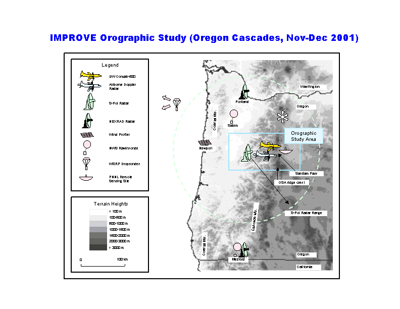
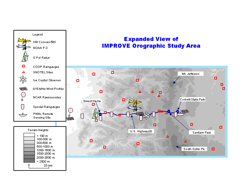
IMPROVE II STUDY AREA MAPS