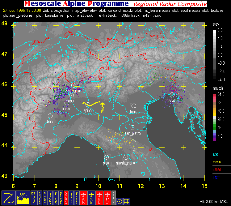
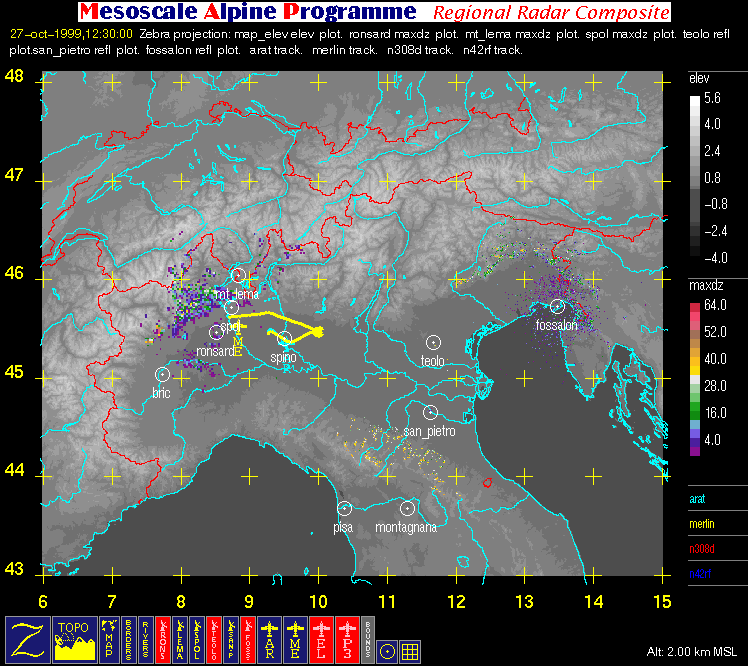
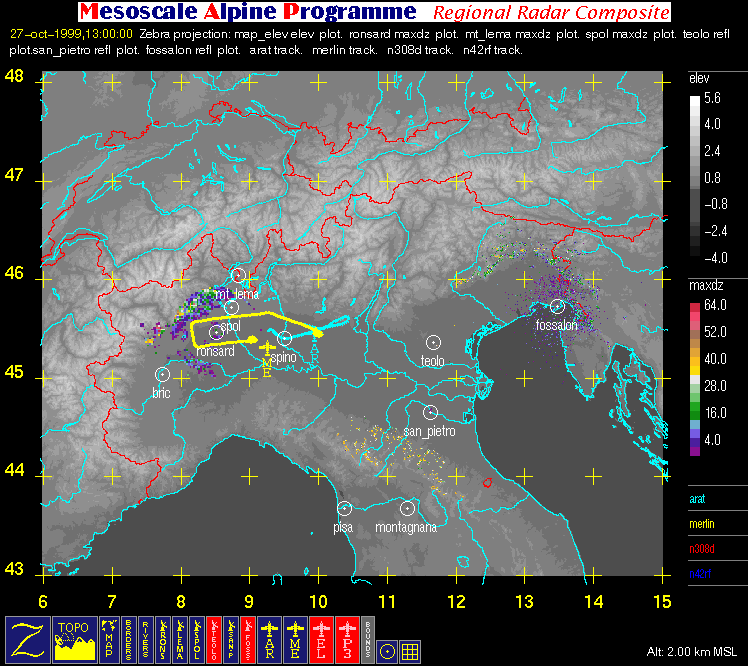
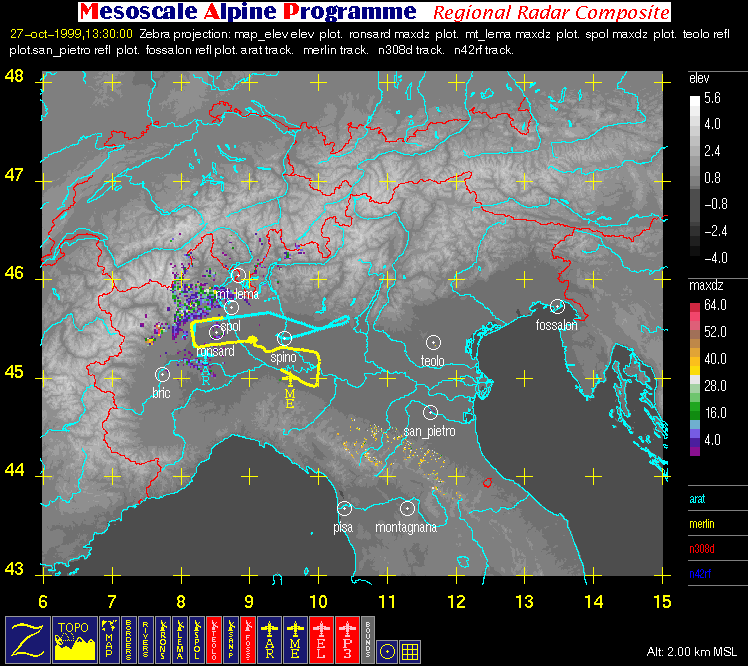
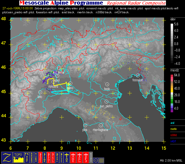
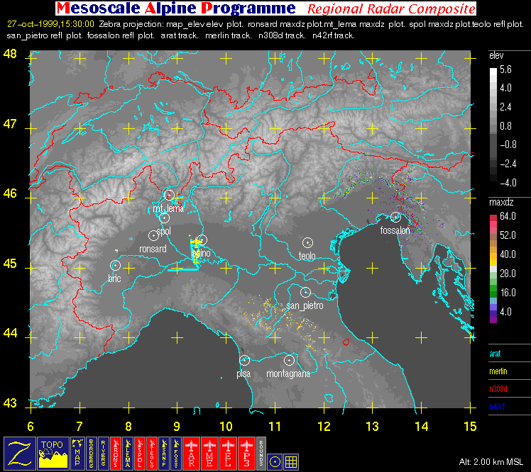
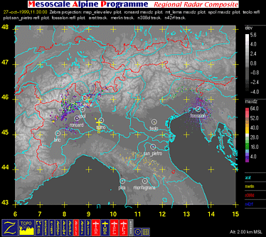
GROUND-BASED RADAR AND FLIGHT TRACK SUMMARY: IOP 11
26 - 27 October 1999
This summary consists of Scientist notes and various
Graphical products that may contain aircraft flight tracks and/or
radar data overlaid with topography.
Scientist Notes
Click on one of the following links for scientist notes corresponding to this IOP:
Graphical Products
There is 1 type of graphical product that may be contained in this summary:
| Aircraft in Operation |
Time of Takeoff (UTC) |
Time of Landing (UTC) |
| ARAT |
1227 UTC 27 OCT |
1449 UTC 27 OCT |
| Merlin |
1044 UTC 27 OCT |
1433 UTC 27 OCT |
| |
Color-Key to Aircraft Flight Tracks: |
| |
Arat Flight Track |
| |
Merlin Flight Track |
| |
Electra Flight Track |
| |
P3 Flight Track |
| |
Color-Key to Geographic Contours: |
| |
Rivers (thin) |
| |
Map Boundaries (thin) |
| |
Political Boundaries (thin) |
| |
Color-Key to Other Graphical Overlays: |
| |
Radar Range Rings (spacing = 20 km) |
| |
Lat/Lon grid (+) |
| |
Dual-Doppler Lobes (thin) and Horizontal Position
of Vertical Cross-sections (thick) |


