GROUND-BASED RADAR AND FLIGHT TRACK SUMMARY: IOP 04
30 September - 02 October 1999
This summary consists of Scientist notes and various
Graphical products that may contain aircraft flight tracks and/or
radar data overlaid with topography.
Scientist Notes
Click on one of the following links for scientist notes corresponding to this IOP:
Graphical Products
There are 4 types of graphical products that may be contained in this summary:
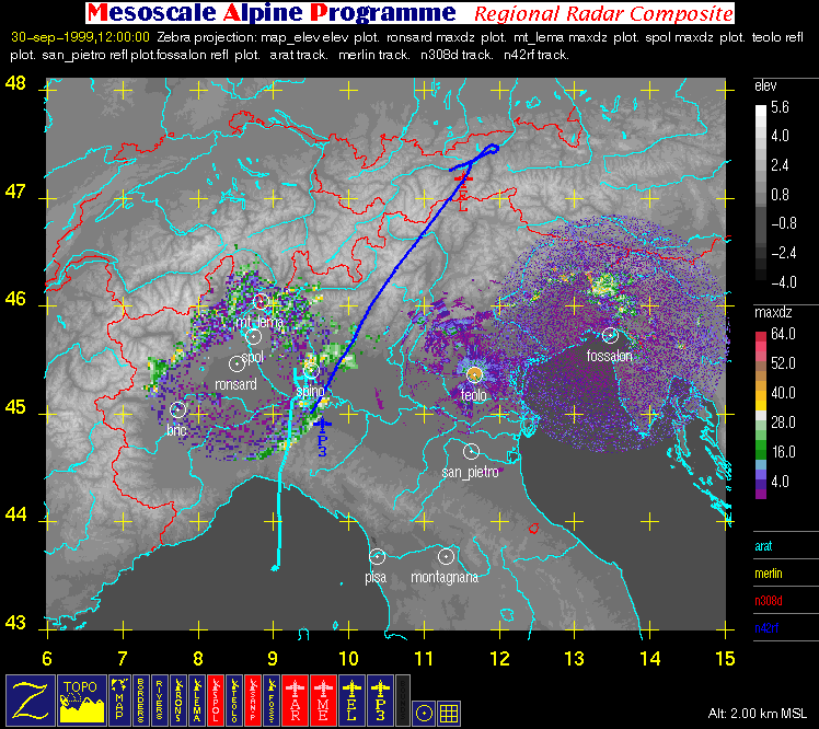
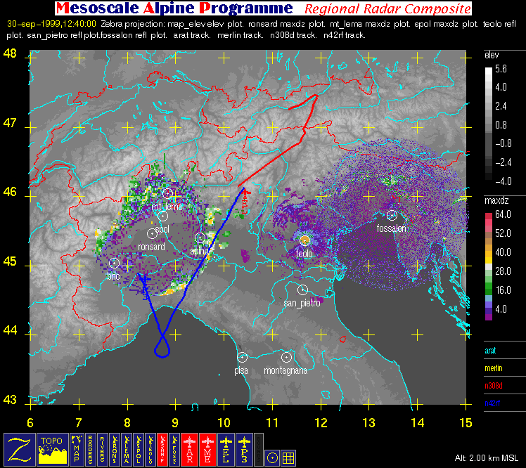
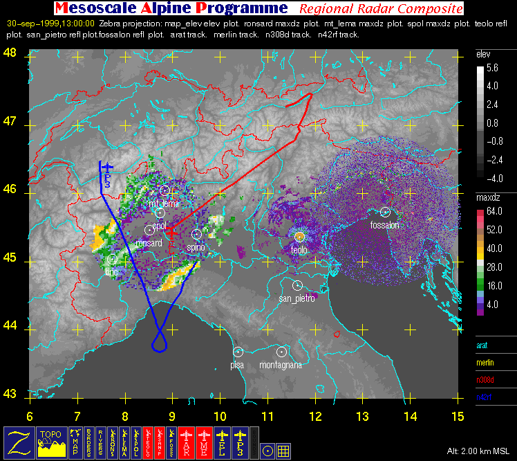
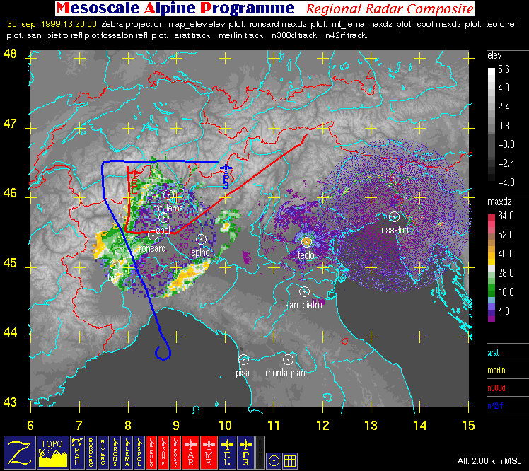
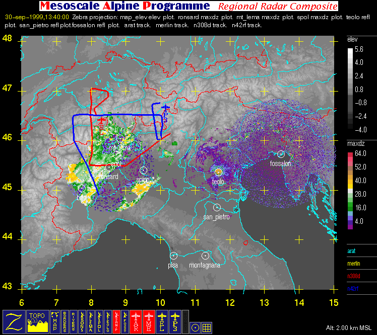
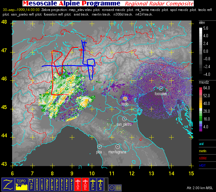
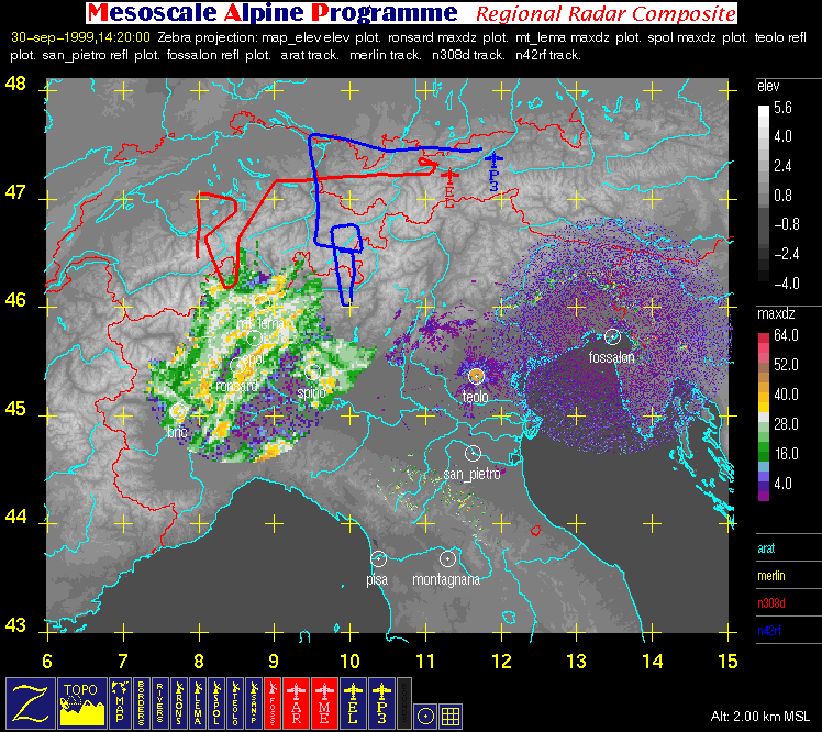
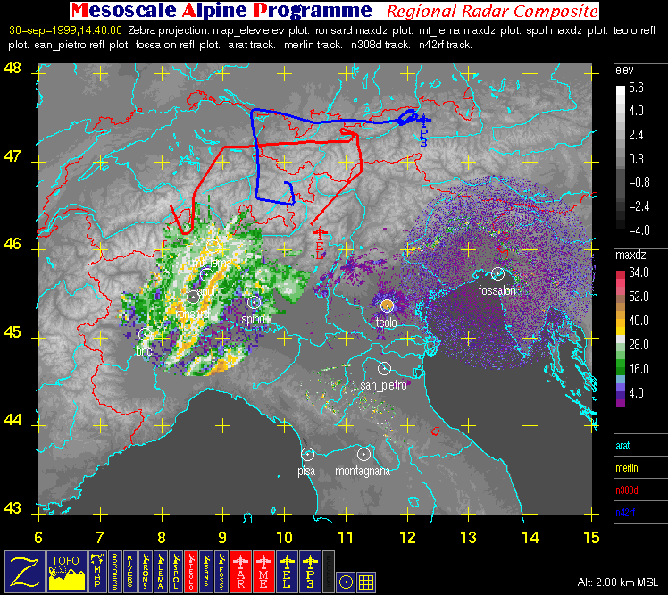
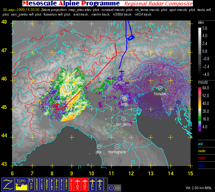
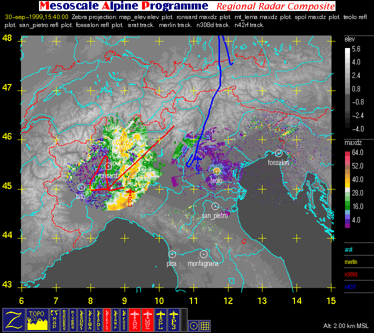
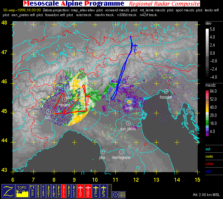
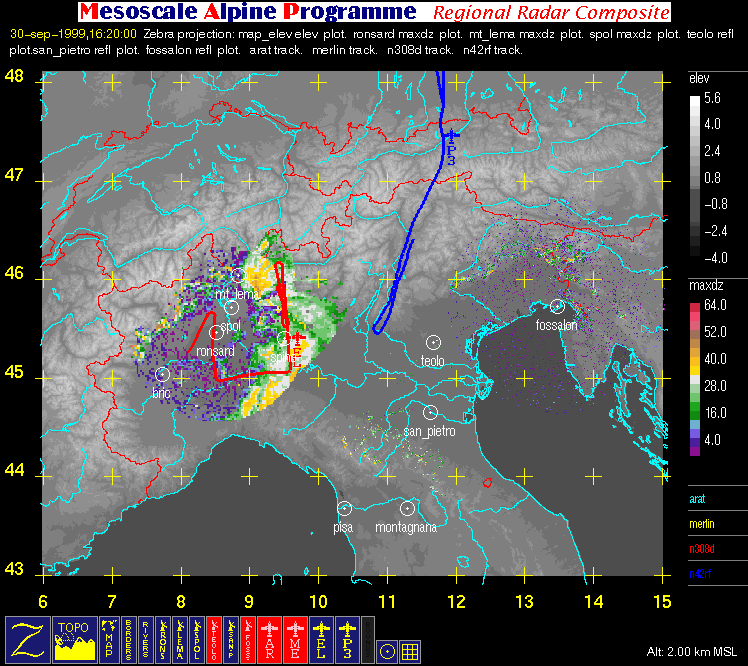
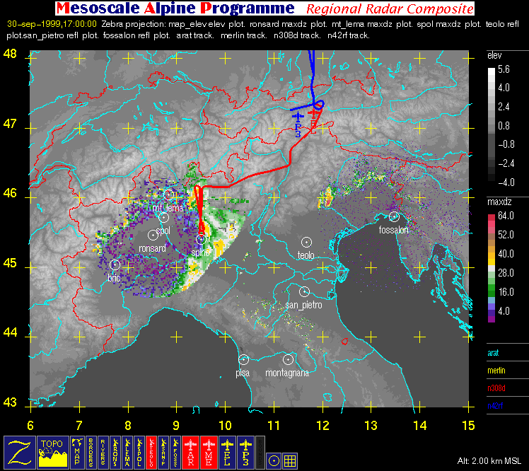
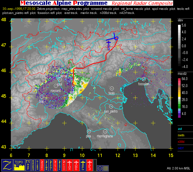
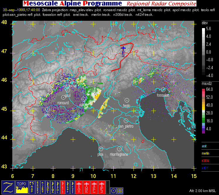
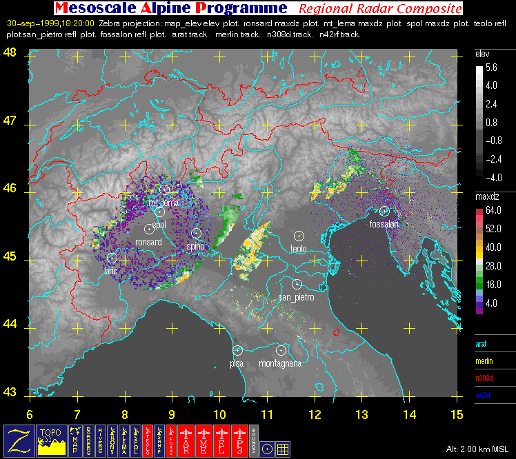
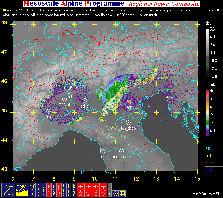
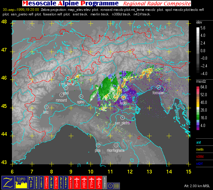
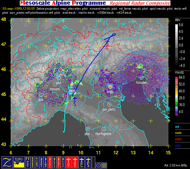
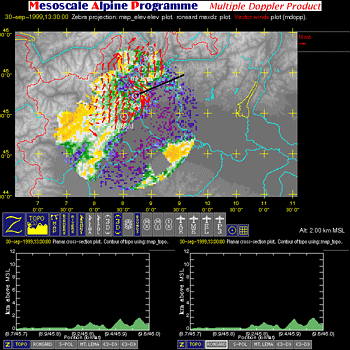
- Regional Radar Composite (with aircraft flight tracks where available): large horizontal image (2 km MSL) covering the region bounded by 6° E, 15° E, 43° N, and 48° N that contains flight tracks superimposed on radar data and geography.
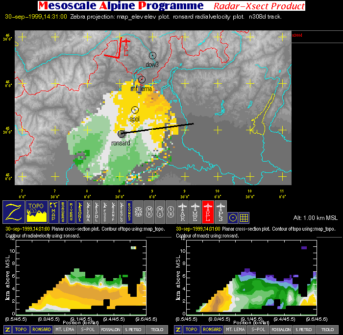
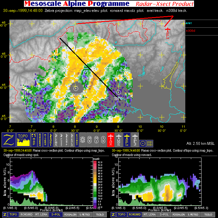
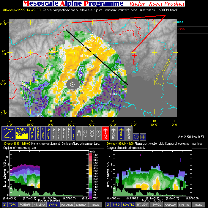
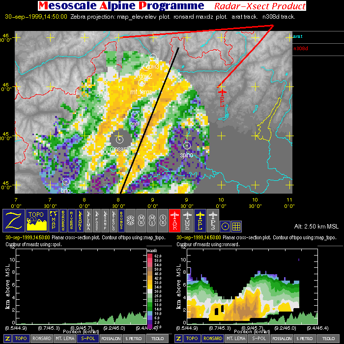
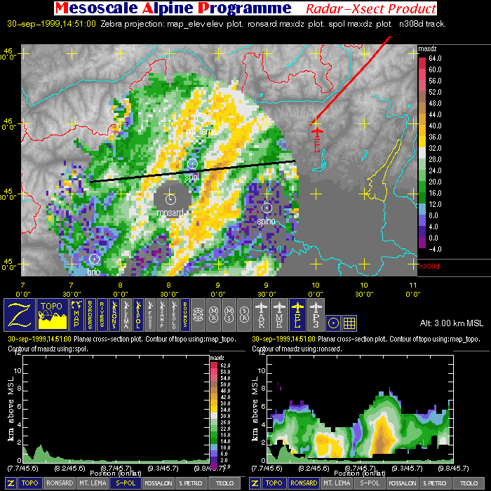
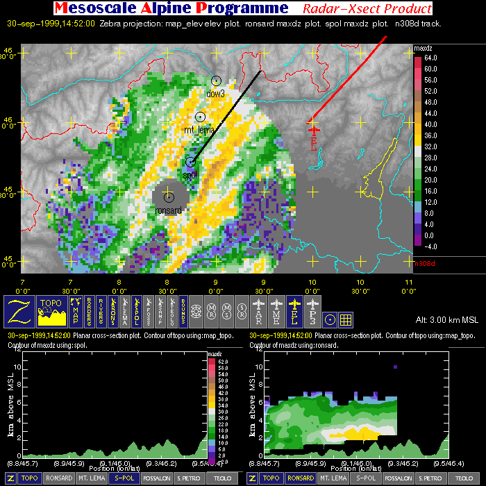
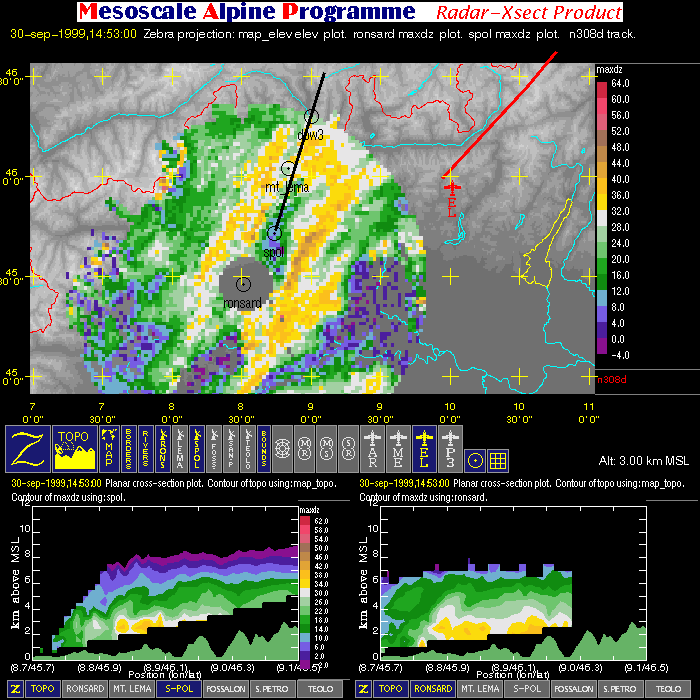
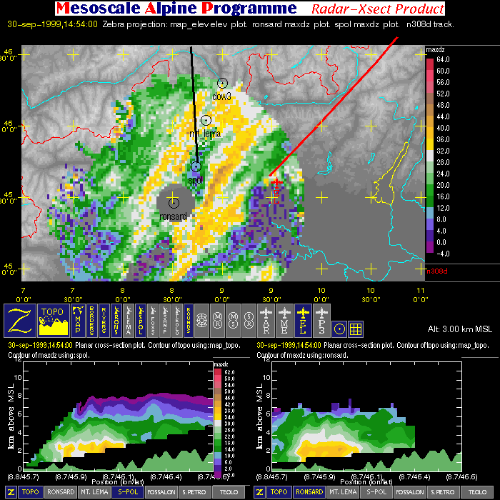
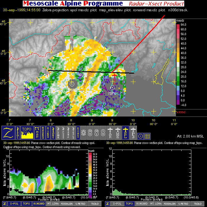
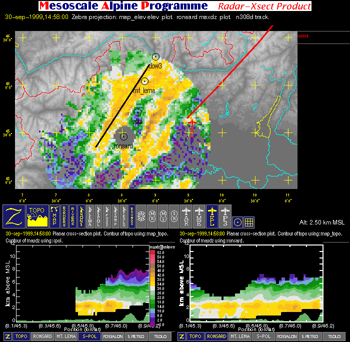
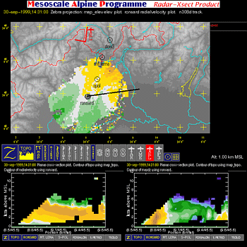
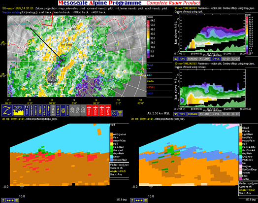
- Radar Cross-section: image with one horizontal cross-section (containing flight tracks, radar data, and geography) and two vertical cross-sections (containing radar data and terrain).
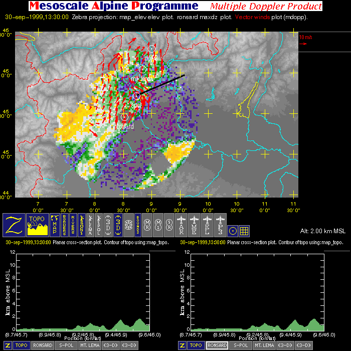
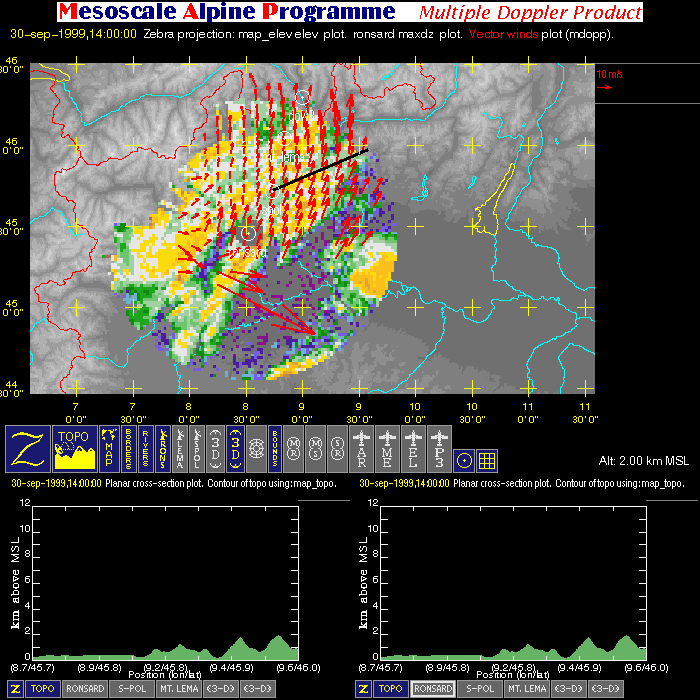
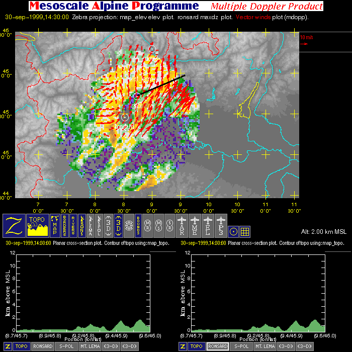
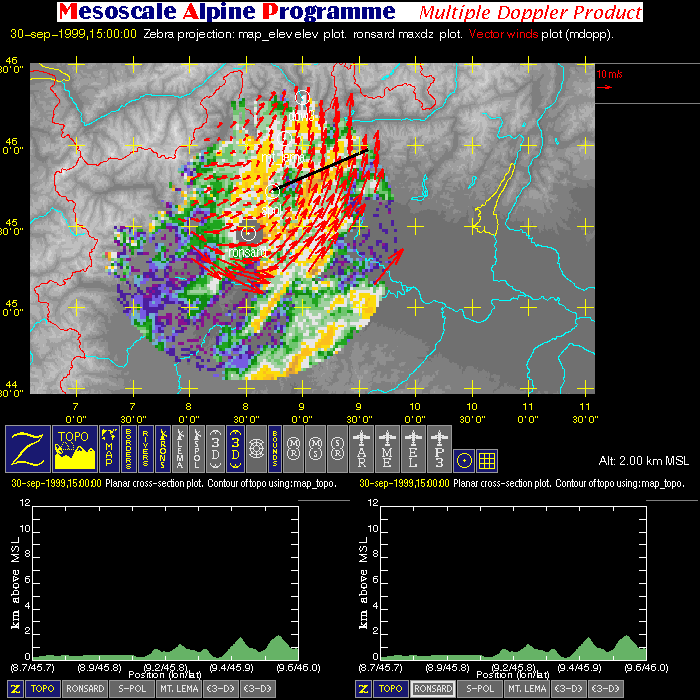
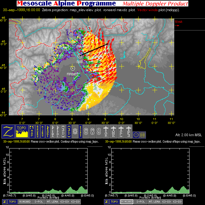
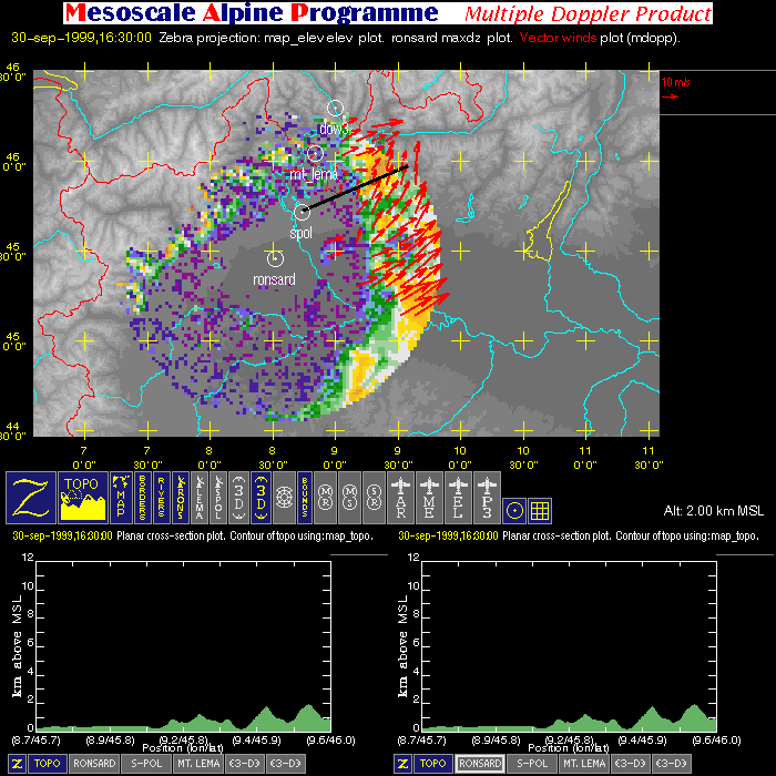
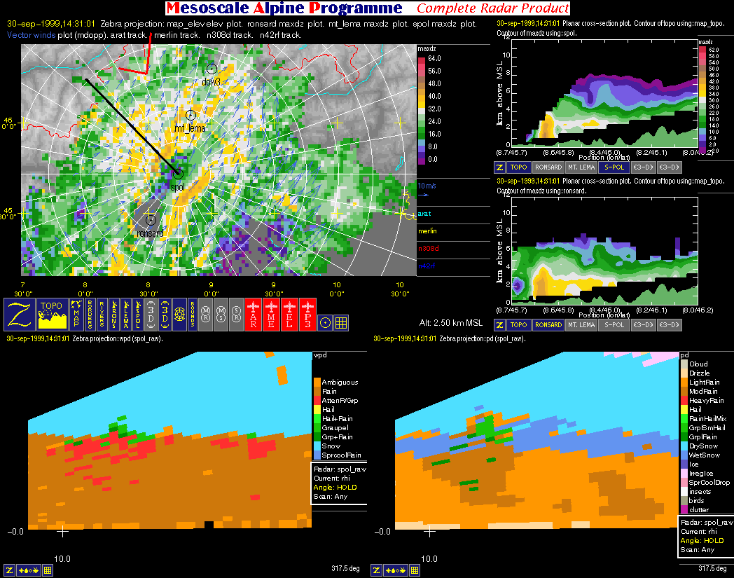
- Multiple Doppler: image with one horizontal cross-section (containing flight tracks, multiple-doppler fields, radar data, and geography) and two vertical cross-sections (containing multiple-doppler fields, radar data and terrain).
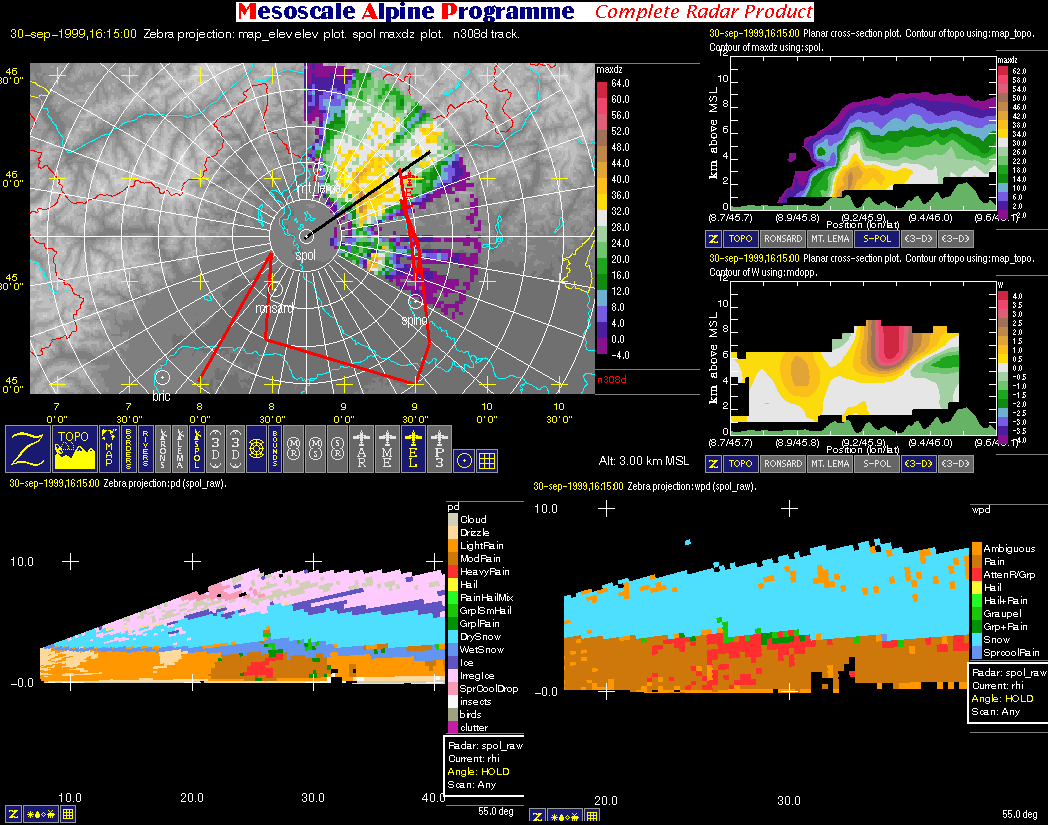
- Particle-type: image with one horizontal cross-section (containing flight tracks, multiple-doppler fields, radar data, and geography), two vertical cross-sections
(containing radar reflectivity, radial velocity, and terrain), and two RHI's (containing particle-type fields determined by two different algorithms).
| Aircraft in Operation |
Time of Takeoff (UTC) |
Time of Landing (UTC) |
| Merlin |
1050 (Sept. 29); 1233 (Oct. 2) |
1354 (Sept. 29); 1556 (Oct. 2) |
| ARAT |
0805 (Sept. 30) |
1138 (Sept. 30) |
| Electra |
1151 (Sept. 30) |
1706 (Sept. 30) |
| P3 |
? (Sept. 30) |
? (Sept. 30) |
| |
Color-Key to Aircraft Flight Tracks: |
| |
Arat Flight Track |
| |
Merlin Flight Track |
| |
Electra Flight Track |
| |
P3 Flight Track |
| |
Color-Key to Geographic Contours: |
| |
Rivers (thin) |
| |
Map Boundaries (thin) |
| |
Political Boundaries (thin) |
| |
Color-Key to Other Graphical Overlays: |
| |
Radar Range Rings (spacing = 20 km) |
| |
Lat/Lon grid (+) |
| |
Dual-Doppler Lobes (thin) and Horizontal Position
of Vertical Cross-sections (thick) |


